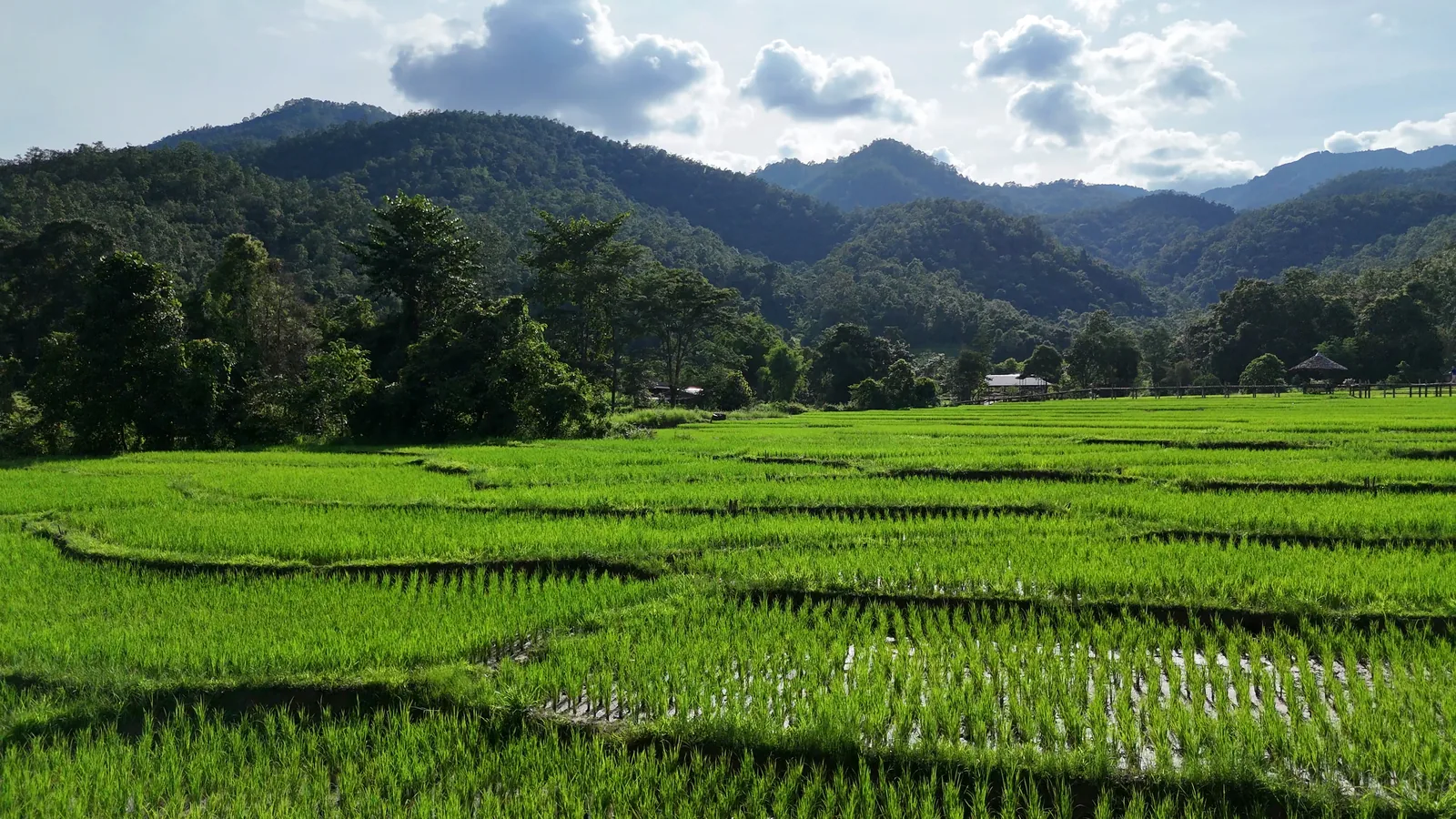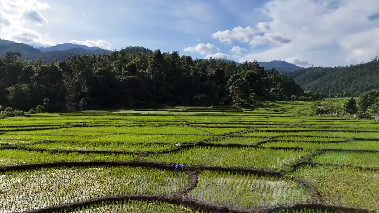
A peaceful walk above the rice fields.
Written by Nolo Hub Pai, Pai’s top social and experience-based hostel
Last checked September 2026
tl;dr
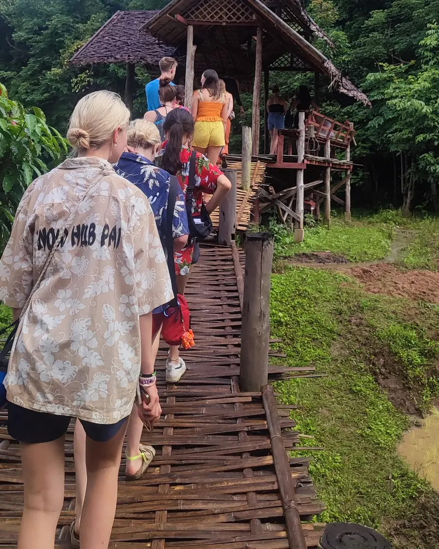
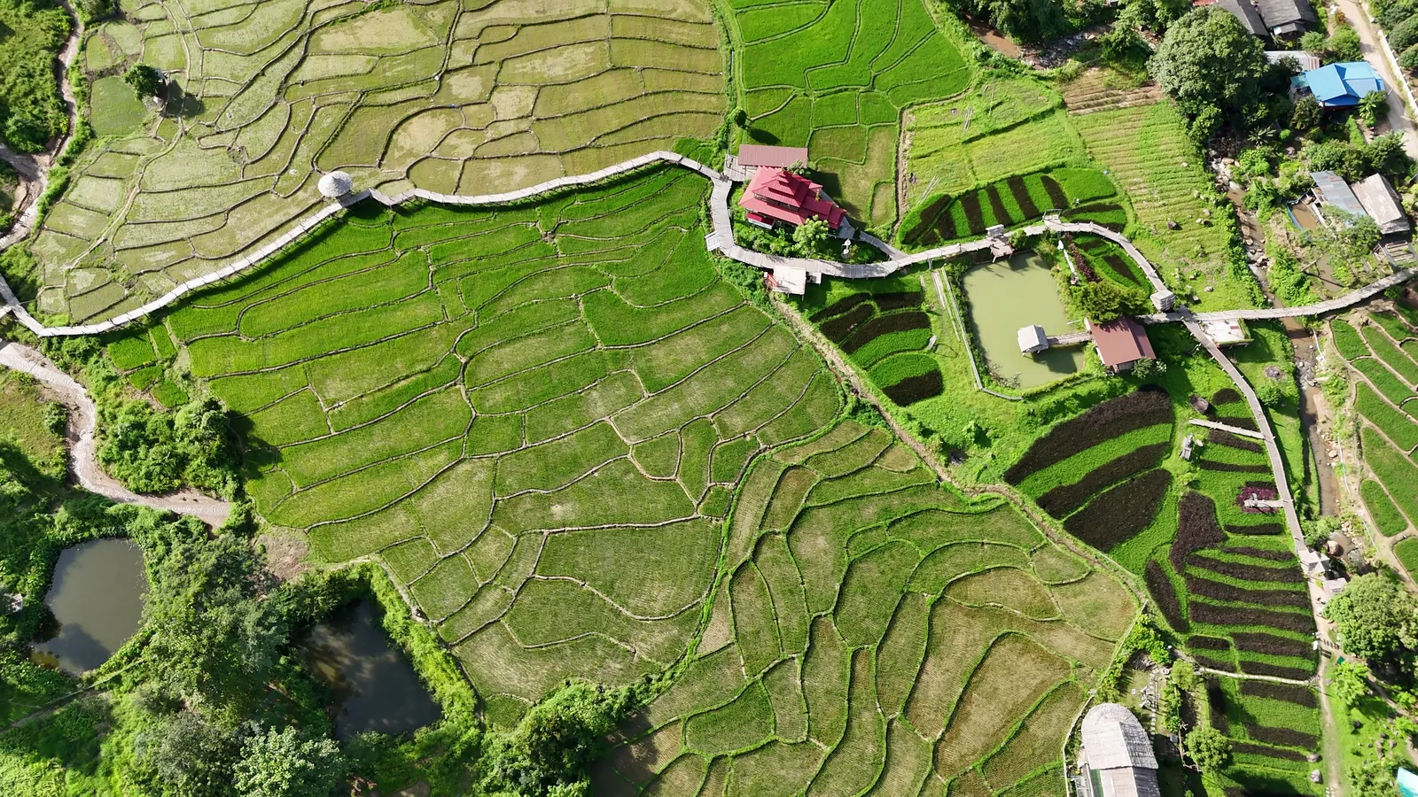
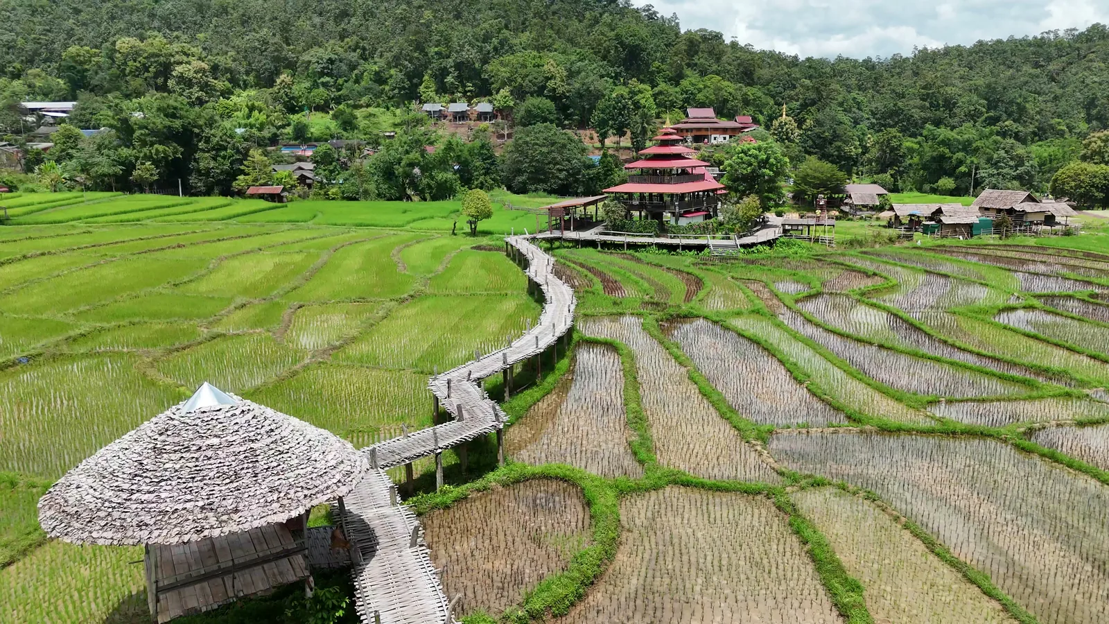
Just outside Pai town, Boon Kho Ku So — the Pai bamboo bridge — is a woven bamboo mat bridge sprawling 815 metres over the rice paddies, connecting a forest monastery to Ban Pam Bok village. It was built in 2016, and not for visitors.
Also known as: Boon Ko Ku So · Boon Kho Ku So · Kho Ku So · Pam Bok Bamboo Bridge · สะพานบุญโขกู้ซู้ · สะพานบุญโขกู้โส่ · โขกู้สุ่ย — the name is Tai Yai rather than Thai, the signs get repainted, and the transliteration shifts with the dialect, so there's no single correct spelling.
Before you go
- Entry
- 30 baht, printed on the ticket as maintenance — as of September 2026
- Length
- 815 metres, about 1.5 m wide, one to two metres above the fields
- From Nolo Hub
- 10.1 km
- Location
- Ban Pam Bok — 19.322551, 98.393248
- Hours
- 08:00 - 17:00 — as of September 2026
- Bring
- water, sun protection, and something to cover shoulders and knees for the monastery
- Map
- Google Maps · Apple Maps
Through the year
- July to October
- tall, bright-green rice
- November
- golden fields before the harvest
- December to June
- Rice fields are harvested, used for buffalo to roam and feed.
Why a village built a walkway over their own crop
To understand why Boon Kho Ku So exists we first need to talk about monks, trampled rice fields and a tradition spanning over 2,000 years.
During the time of the Buddha, monks wandered from town to town year-round to teach and collect alms. Alms, or sai bat, is a daily Buddhist tradition where monks walk through local streets at dawn to collect food offerings from the community. A monk can't grow, store or cook their food. They have to be given it, every morning, or they don't eat.
Farmers began to complain that during the rainy season, wandering monks were trampling newly planted rice paddies and crushing the insects emerging in the mud. To resolve it, the Buddha established a rule: for the three months of the monsoon, monks stay confined to a single monastery. In Thailand this is observed as Vassa, commonly known as Khao Phansa, or Buddhist Lent.
But while Buddhist Lent stopped monks wandering between villages, it never covered the walk to breakfast. The monks at Wat Pa Huai Khai Khiri — the forest monastery at the end of the bridge — still had to reach Ban Pam Bok every morning. Before 2016 that meant a choice between a long detour crossing two streams, or cutting straight through the paddies and trampling the young rice.
In April 2016 a monk named Phra Ajahn Sakhon Charuthammo worked with local farmers to fix it. Villagers donated strips of their own farmland, put up the funds, and spent three months building an 815-metre walkway over the crops, modelled on the Su Tong Pae bridge near Mae Hong Son. It cut the walk to fifteen minutes without trampling a single rice stalk.
The fields underneath are still worked. Every pillar stands in ground somebody farms.
You'll read that it's the longest bridge of its kind in Thailand. We couldn't verify it, and neither could the officer at the ticket booth when we asked.
What your 30 baht pays for
Look under the bridge as you walk across. The bamboo is the surface, not the structure — underneath it are concrete pillars coming straight up out of the paddy, with a metal frame across most of the span.
Which means the part that wears out is the part that grows in the valley and that people here already know how to work. The deck gets rewoven span by span, where and when it's needed, by the same organisation selling the tickets. So if you see fresh pale bamboo next to weathered grey, that's your ticket money, not neglect.
Keep the ticket in your pocket after the entrance. There are two starting points and both funnel through a second checkpoint further along, where it gets checked again.
The temples
Two religious sites sit along this road and visitors routinely confuse them.
Wat Phaem Bok (วัดแพมบก) is the village temple, about 100 metres from the junction.
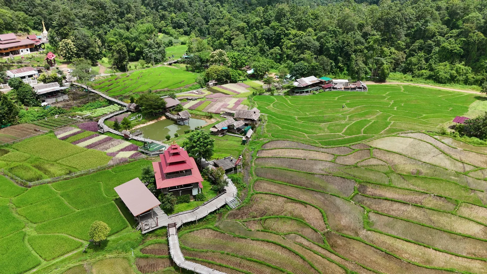
The forest monastery is at the far end of the bridge. Its own signage doesn't agree with itself — the blue directional sign says Samnak Song Huai Khai Khiri, a monastic residence, while the entrance arch and the rules board say Wat Pa Huai Khai Khiri, a forest temple. Both are in local use. The arch carries its own English: Land of Peace.
If you're going in, cover your shoulders and knees, leave your shoes on the rack, and keep your voice down. There's usually a box of wraps near the entrance to borrow, but bring your own rather than counting on it.
The ride out
Head south on Route 1095, then turn right into the Pam Bok valley road and follow it past Pam Bok Waterfall until you see the signs for the bridge.
The valley road has been resurfaced — most sources still describe potholes and broken tarmac, and they're out of date. It's still narrow, steep and winding though. If you're two-up on a 125, take the climbs slowly and test your brakes before you start down.
Head back before 17:00. The monastery closes to visitors then, and the valley road has no streetlights.
If you're not up for the drive we can arrange transport for you at the hostel.